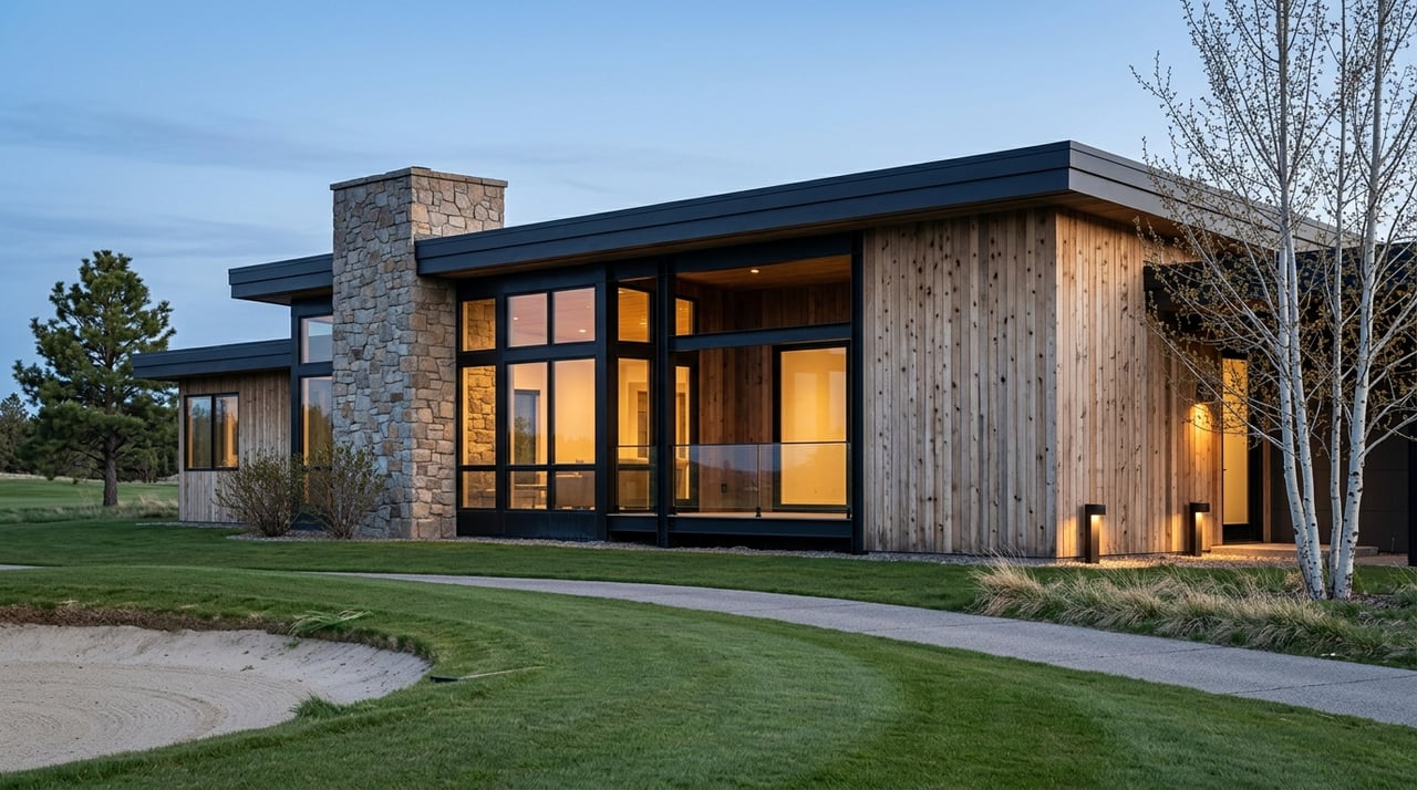
Buying land around Driggs can feel exciting until you open the plat map and run into lines, bearings, and tables you have never seen. You want to be confident about access, buildability, and what those dashed lines mean for your dream home. In this guide, you will learn how to find official Teton County plats, read each key element, and use that information to plan a smart site visit and strong offer. Let’s dive in.
What a plat map shows
A recorded plat is the legal surveyed map of a subdivision or parcel split. It controls over online parcel viewers when the two do not match. You will see lot lines, measurements, easements, rights of way, and notes approved by the county. Use it to verify boundaries, access, and where a home could go.
Where to find Teton County plats
Start with three local sources to confirm you have the official record and correct context:
- Teton County GIS Parcel Viewer for interactive parcel maps, aerials, zoning, and flood overlays. Use this to identify the parcel number and general boundary location.
- Teton County Recorder for the recorded plat PDF, easements, CCRs, and road agreements. Ask for the recorded plat rather than relying on screenshots or marketing images.
- Teton County Planning and Zoning for subdivision rules, setbacks, and any plat-specific conditions. If the property is inside Driggs city limits, contact City of Driggs Planning for city regulations.
Also cross-check with the Teton County Assessor for parcel data and ownership, and Teton County Road and Bridge for public right-of-way status and seasonal maintenance. Title companies and licensed land surveyors can help verify boundaries and recorded encumbrances.
How to read the map step by step
Title block and recording info
- What to find: subdivision name and phase, recording book and page or document number, date, and recorder’s stamp.
- Why it matters: this confirms the exact legal document to reference in your deed and title work.
North arrow, scale, and basis of bearings
- What to find: a north arrow, a graphic scale, and sometimes a statement of the basis of bearings used for directions.
- Why it matters: surveyors use these to recreate boundaries. If you commission a boundary survey, the basis of bearings helps align the work.
Lot lines, numbers, and acreage
- What to find: the outlined lot with a lot number and area in acres or square feet.
- Why it matters: check that the platted acreage matches assessor data and the listing. This is the lot you are actually buying.
Bearings, distances, and curve table
- What to find: straight-line bearings with degrees, minutes, and seconds, distances in feet, and curved segments listed in a curve table.
- Why it matters: these are the legal boundary measurements, essential for resolving any corner or fence-line questions.
Monuments and witness corners
- What to find: symbols for iron rods, rebar, or concrete monuments at corners, plus notes on whether they were set or found.
- Why it matters: monuments let a surveyor and sometimes you physically locate corners in the field. Missing monuments may require a new survey.
Easements
- What to find: labels such as UE or PUE for utility easements, drainage easements, and ingress/egress or access easements, usually with widths.
- Why it matters: you typically cannot build structures within easements. Some easements allow others to cross your land or place utilities. Ask for the recorded easement instrument to confirm rights and maintenance.
Rights of way
- What to find: R/W or R.O.W. labels, often 60-foot or similar corridors, sometimes with centerline bearings.
- Why it matters: a dedicated public right of way grants room for roads and maintenance. Private roads usually require recorded road maintenance agreements.
Building envelopes and setbacks
- What to find: a clearly outlined building envelope within the lot or dashed setback lines from lot lines, roads, or easements.
- Why it matters: the envelope or setbacks define your buildable area. On mountain or sloped lots, the practical area can be smaller than it looks on a map.
Restrictions, notes, dedications, and certificates
- What to find: county approval block, surveyor’s certificate, and notes such as stream buffers or no-build zones.
- Why it matters: recorded notes are binding and can affect utilities, site grading, and structure placement.
CCRs and private agreements
- What to find: the plat may reference recorded CCRs, design guidelines, and road maintenance agreements.
- Why it matters: CCRs can be more restrictive than county zoning and may require design review or limit certain structures or uses.
Overlays and constraints
- What to find: floodplain lines, drainageways, slope or view easements, and septic reserve areas where applicable.
- Why it matters: these constraints affect feasibility, foundation design, and permit eligibility, especially near waterways.
Turn map details into smart due diligence
Use the plat details to focus your questions and the documents you request:
- Confirm legal access. Identify if access is via a public road, a dedicated right of way, or an ingress/egress easement. If by easement, request the recorded agreement and any road maintenance document.
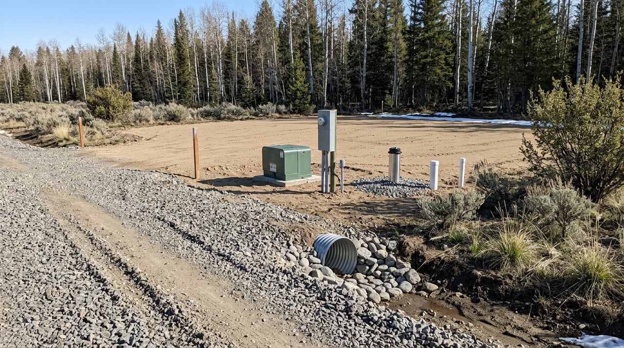
- Check utilities. Look for utility easements and corridors. Call local providers to verify service routes, especially for power to remote acreage.
- Verify buildable area. Follow the envelope and setbacks on the plat. If none are shown, get setbacks from county or city zoning.
- Account for slope and soils. Steeper terrain common around Driggs can limit siting and add cost. Consider a topographic or site feasibility survey early.
- Review septic and well feasibility. Contact county environmental health for septic requirements and Idaho Department of Water Resources for well permits or water rights records.
- Evaluate flood and wetlands risk. If near the Teton River or tributaries, check floodplain overlays and local rules for building elevations and setbacks.
- Clarify private road obligations. Request recorded road maintenance agreements and confirm plowing responsibilities and standards for emergency access.
- Gather all referenced documents. If the plat references CCRs or separate easements, ask for those recordings and a title commitment listing exceptions.
On-site checklist for Driggs acreage
Bring the recorded plat PDF and use it to ground-truth the property:
- Locate any corner monuments described on the plat; note if they are missing or disturbed.
- Walk easement corridors and look for visible signs like poles, transformers, swales, or paths.
- Drive the access route and photograph gates, signage, and surface conditions.
- Identify potential build sites within the envelope or outside easements and steep slopes.
- Mark GPS points and take photos of corners, stakes, and any visible encroachments.
- Note drainage patterns, rock outcrops, and soil conditions that may affect foundations or septic.
- Ask the seller for title commitments, CCRs, road agreements, well logs or permits, septic permits or evaluations, and any prior surveys.
Who to contact in Teton County
These offices and professionals provide authoritative information. Call or search the office names below:
- Teton County GIS or Parcel Viewer for parcel layers, aerials, and zoning overlays.
- Teton County Recorder for recorded plats, easements, CCRs, and road agreements.
- Teton County Planning and Zoning for setbacks, permitted uses, and plat conditions.
- City of Driggs Planning if the property is within city limits.
- Teton County Assessor for parcel numbers, assessed acreage, and ownership.
- Teton County Road and Bridge or County Engineer for road classification and maintenance status.
- Teton County Environmental Health for septic approvals and requirements.
- Idaho Department of Water Resources for well permits and water rights records.
- Licensed Idaho land surveyors and local title companies for boundary surveys and title commitments.
- FEMA flood mapping resources to confirm floodplain status.
Make your offer strong
Write your offer to include the homework you need and the time to complete it. Use the plat to define what you will verify during due diligence.
- Include contingencies for a boundary survey, septic feasibility, and well or water rights checks.
- Add a title review period to study recorded easements, CCRs, and road agreements.
- Confirm zoning and setbacks with county or city planning. Document any needed approvals for your intended improvements.
- If corners are missing or fences do not match the plat, require a licensed Idaho surveyor to set or verify monuments.
Common local pitfalls to avoid
Teton Valley’s beauty comes with a few site realities. Plan for them so you are not surprised after closing.
- Mountain slopes can shrink buildable area and raise grading or foundation costs.
- Private roads may have seasonal access limits and shared plowing costs.
- Septic systems can require specialized designs where soils are thin or slopes are steep.
- Long-used tracks across land may be unrecorded. Use title work and a survey to clarify access.
- Parcels near conservation or scenic easements can have development limits. Request any recorded restrictions early.
Buying land here rewards careful reading and on-the-ground verification. When you pair the recorded plat with site checks, title documents, and calls to the right offices, you can buy with confidence and a clear plan for building. If you want experienced, local guidance tailored to Driggs and greater Teton Valley, connect with Grand Associates for practical help from first look to closing.
FAQs
What is the official source for a Driggs lot’s boundaries?
- The recorded plat and the legal description in the deed control. Assessor parcel maps are for taxation and may be less precise.
How do easements on a Teton County plat affect building?
- You typically cannot place structures within utility or access easements. Review the recorded easement document and confirm rules with county planning and a surveyor.
What if the plat shows a road right of way that is not built?
- A dedicated right of way authorizes road use and maintenance within that corridor. Whether it is constructed or county maintained depends on local policy and recorded dedication language.
How can I tell if a Driggs lot is buildable from the plat?
- Look for a building envelope and setback lines on the plat, then verify slope, soils and septic feasibility, floodplain status, and zoning or permit requirements with local offices.
Who maintains a private road serving my prospective lot?
- Maintenance is usually defined in a recorded road maintenance agreement or in CCRs referenced on the plat. Request those documents and confirm dues and plowing responsibilities.